Thursday, March 10, 2011

Shocking housing ...

[our Cederberg map offer is still valid - see second blog below]

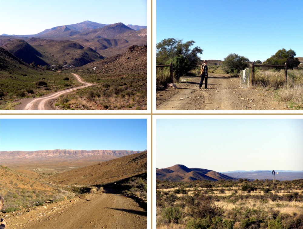
One of the more pleasant aspects of mapping large rural areas such as the Swartberg or the Cederberg, the Baviaanskloof or the Overberg, is that we have to drive every driveable road - every highway and every byway. It's the byways that are the best, full of wonderful surprises, full of those "you'd never guess it was here" moments.
But the byways - and even the highways - also have their sadder, their gut-wrenching moments. As we've driven around these magic places, our notebooks filling up with distances and scribbles, our cameras clicking, we've gradually become more and more sensitized to one of the most disturbing - and disgusting - sides of rural life in the Cape.

On many farms - on more farms than ever before - from wine farms to wheat farms to mixed grazing and grain farms - there has been an enormous improvement in the standard of housing for farm workers. The houses may be modest in size, but they have neat gardens, glass in the windows, clean walls, TV aerials, electricity connections ...

Which is as it should be. Farm workers, especially in the Western Cape, are potentially the most marginalised of South Africa's people. They [usually] don't own their houses; they are tied to their farms, almost as securely as they were tied in the days of their slave forefathers, their ancestors from the shattered clans of the Khoi and San. They have nowhere else to go, and they do not even have the remnants of tribal support structures to fall back upon. Huge numbers of enlightened farmers have responded to their plight, and it's not just in housing either, it's also in training programmes, from tractor driving to high managerial positioning.

But not everywhere. Drive north out of the leafy suburbs of the west end of Oudtshoorn, on the back road to Schoemanshoek and its lofty church, its boutique wine estates and guest houses. Across the valley, not far away, the Cango Caves road carries thousands of tourists past ostrich palaces, crocodile farms and cheetah sanctuaries, all entreating you to spend your bucks, have a good time. The tar ends and you leave the SAPS Dog Training school behind. The guest houses and lodges are only a few kilometres away, but before you reach them you'll pass these places.


At first you might think they are ruins ... but they're not. They all belong to a farmer somewhere, and they all have people living in them, people who don't own them. They have no windows, almost no roofs, no electricity ... what they must be like inside in the 40 degree Oudtshoorn summers and minus 10 winter nights is, well. Every one of them houses young South African children, everyone of them houses people, people with hopes and dreams and needs.

But those houses are quite out of the way, not many people get to see them, so we needn't be too concerned that our tourists will be upset by them. However, at Herold, near George, there are some very larny places to stay, yet another wine estate, and a National Road, the N9, running past not far away. The house on the left is right in the town of Herold, the houses on the right are at Doringrivier farm, next to the N9 highway, at Herold.


Here's a funny thing. It's a Local Government election year in SA. Politics are heating up - the ANC says there are too many Coloured people in the Western Cape and the Freedom Front says there are too many black people in South Africa [only joking]. Two of the mayoral candidates for Cape Town might be Tony Ehrenreich, head honcho of the trade union movement Cosatu in the Cape, and Patricia de Lille, Minister of Welfare in the Cape Provincial government. I might have missed something, but I have never heard either of these worthies addressing the housing plight of thousands of Western Cape people in the rural areas ... have you? Ever heard Tokyo Sexwale, Minister of Housing, on the subject? Helen Zille? Julius Malema? Marthinus god-bless-im van Schalkwyk, Minister of Tourism? President Zuma?

The answer is No, because the children in these houses, and their parents, just don't count. And if the tourist view from the national highways is bad, well, too bad!

Last two pics. The first is off the N9 in the Long Kloof, less than 7 km from the wine estate of a well-known SA golfing hero; I wonder if he's ever stopped and looked at it. The other is near Goudini, home of many huge wine estates including some that boast a lot (especially overseas) about their fair labour practices ...


In his poignant song "Dans mettie dood" (Dance with Death) David Kramer sings poignantly and brilliantly of the lot of these forgotten, cast-off people ... [translation below]

ek trek ’n skuif en ek drink ’n bier
ek soek jou lyf vir my plesier
hoeners pik die bitter grond
kinners hardloop kaalgat rond
ek dans mettie dood
die lewe bly maar duur.

I pull on a smoke and I drink a beer;
I look to your body for my pleasure.
Chickens scratch in the bitter earth,
children run around naked ...
I dance with death -
This life just costs too much.

I can't get Kramer's rhyming metre into my crude translation, I'm afraid ... but I'll save more pictures for another time.

In the meantime, if you have pics of Shocking Housing, mail them in. We're thinking of starting a dedicated website, to name and shame the landowners who perpetuate this awful squalor upon our countrymen, in our fair land.

Kaartman.

PS I'm hoping to find some emails for the politicians, so you can mail your thoughts to them directly.


Monday, February 28, 2011

Patterns

CEDERBERG MAP OFFER : SEE BLOG BELOW

One of the passing pleasures of making maps is the opportunity to see the most wondrous patterns in the landscape. You can see these in aerial photographs, but when the essence of the landforms is extracted through contours or river systems there's a purity that photos mask.
Look at these extraordinary Swartberg contours:


I'm sorry the blog doesn't allow me to put them up in more detail. Here are some Swartberg river systems:


And here's a real oddity - a map of the Central Cederberg as it was in 1651!


I want to see some fabric printed in these patterns - maybe the most gifted and creative Heather Moore could give it a shot? Heather? Visit Heather at http://www.skinnylaminx.info/ .

Of course the landscape textures aren't only there in the macro-geography. All the following are textures from the extraordinarily rich Swartberg and Klein-Karoo. They make great background patterns, too:


That's all for the moment. Don't forget that the offer on Cederberg 9 maps still pertains: see blog below.

Cheers.
- Kaartman

Friday, February 4, 2011

Greatmen fatmen

Great men are almost always bad men ... There is no worse heresy than the fact that the office sanctifies the holder of it.
- Lord Acton

Acton, a prominent English historian, is also the same Engelsman who penned the famous quote about absolute power corrupting absolutely. He might have added that great men (or women) are almost always grossly overweight, especially in Africa.
I've never really undertood why so many self-serving politicians feel the need to overindulge themselves to the point of disgusting obesity; sadly, remarkably few seem to pay the penalty of heart attacks and bad chloresterol numbers, but maybe they get special dispensation for this. Or they can command the best doctors. Big men apparently need Big Bums.

Last week was a truly remarkable week, for events at completely opposite ends of the African continent. In the south, millions held their breath for the health of a leader who is rightfully the icon of their national freedom. He really was - is - a Good Great Man, much less of a paltry politician than the true Father of a Nation. Your long good health, Madiba!

At the other end of our continent, millions poured out upon the streets demanding the end of just another self-serving, self-appointed, overweight dictator who believes himself sanctified by the name of his office.
We won't go into what was was happening in the huge continent in between, though there were probably a few tense moments in a presidential palace or two.

What's all this got to do with mapmaking? Lots, actually. Maps have traditionally been amongst the most political of documents. European kings, princelings, dukes, earls and other bad great men won or lost kingdoms, principalities and fiefdoms over maps and mapmakers. Modern states overlorded by overweight megalomaniacs deliberately distort maps to secure their kingdoms - you should see the old USSR's road maps.

India, an ostensible democracy, forced Google Earth to fuzz out air photos of "sensitive" military facilities. Why? Not so that "enemy" states couldn't see them - you can be sure that Pakistan doesn't study India via Google Earth! - but no, so that their own citizens couldn't count the missiles. That's called democracy, hay. Great men ... BAD men. Liars, cheats, the whole bladdie lot.


We had to divert from mapping the Swartberg this week to attend to a crisis in the Cederberg, of which much more soon. There are lots more political things to say about the Swartberg, but we'll get to that.

In the meantime, if you think it's not all about geography, consider this. Two cities on almost exactly opposite sides of the planet, one facing a million-man march to displace a tinpot dictator, the other facing cyclone Yasi, said to be worse than Katrina. Can you name the only two cities on earth whose names begin with C A I R ... ?

Funny old world, hay.

Thursday, January 27, 2011

Die Saaie

If you hate the Laingsburg-Beaufort West stretch of the N1 like any normal person, there's an utterly delightful way of getting to Prince Albert "off the tar". Turn off the Ladismith road from Laingsburg at the Floriskraal Dam turn-off and head eastwards. You need a vehicle with a reasonably high clearance, but 4x4 isn't strictly necessary. You also need a willing co-driver to open the gates; there are 22 of them on the 150km to PA. If your passenger complains, tell them to think about how fit all that hopping in and out of the car is making them.

Don't be put off by the game farm gates that are plastered with "Private" notices - it's every inch a public road. Just shut the gates behind you, that's all.

The road runs up a long valley north of the Witteberg, the foothills-range that marches with the Swartberg from west to east. Before the Dwyka River the valley is known as the Agtersaai. There are two "saaie" - the Voorsaai and the Agtersaai, so named because the Karoo geology has caused the vegetation to grow in long rows, resembling seed-sown farmlands. The Doekberg separates the two Saaie - "doek" literally meaning "screen", because the hills screen the view of one Saai from the other.

Lekker names, hey?

Top left: Floriskraal; Top right: Gate 11
Bottom left: Witteberg from the Doekberg; Bottom right: Agtersaai


About 43 km from PA you have to cross the Dwyka River, but the drift is usually dry or very shallow. We watched a brace of spoonbills gaggling about in the mud there; odd birds with very odd beaks. "Dwyka" means salty or "brak" river; it's a Khoi name, probably ancient, and it's a tributary of the Gamka or "lion river".

When we told an acquaintance that we were mapping the Swartberg he was furious. He'd just bought a retirement cottage in Prince Albert and was looking forward to quiet times. "Your *** map will bring hundreds of noisy tourists, you ***", he said.

He should have counted the places to stay in PA before he bought his cottage. There are nearly fifty of 'em with hundreds of beds, all opened long before we thought of a map ...

Shame, hey.

Does anyone know the name of the RDP township at Prince Albert? We couldn't find it anywhere ... the PA Tourism Bureau's website ignores the former "coloured" township entirely - even the PA Primary School is not listed as a local school! Seems a bit Old-RSA, but there it is.

Thursday, January 20, 2011

Floods ...

January 2011 has been a terrible month for floods ... floods in Sri Lanka, Australia, Brazil, and even here in Pretoria, Upington and Natal. Thousands have lost everything they possess, hundreds have lost their lives. It's easy to forget that exactly thirty years ago, on January 25 1981, there was a flood in the Karoo so violent that engineers described it as a 'one-in-two-thousand-years' event. An incredible 200mm of rain fell in just eight minutes on the already-sodden Moordenaarskaroo, and a wall of water tore down the Buffels River. In minutes it destroyed more than half of the little town of Laingsburg, and over a hundred people lost their lives.

If Laingsburg had been the size of present-day Cape Town, the number of lives lost would proportionately have been nearly half a million ...

We started the research for our map of the Swartberg and the Little Karoo in 2009, but in reality it started much, much earlier. In 1991 - ten years after the flood - we visited Laingsburg to confirm details for a novel I was writing about the flood. We stayed in the Laingsburg Hotel, its passages hung with poignant photographs of the disaster, of distraught people, helicopters, destroyed homes. We drove down the Ladismith road to the Witteberg Bridge, and out on the farm road to Geelbek, seeking locations along the river for our tale. The bone-dry bed of the Buffels River was several hundred metres wide, showing flashes of colour between the karoo-brown stones - bits of motor car, here a mangle, there a kettle, here a piece of old, brass bedstead. Ten years after the flood the signs were still everywhere, even to the mats of dried grass in the very tops of the surviving trees.

I've spent most of the past week mapping in and around Laingsburg, deliminating its contours and its dry river bed, its bustling National Main Road, its sleepy township named by the locals after the huge sign, picked out in white stones on the dry hill behind the town - 'Dra Wol' ('Wear Wool'). It's been a memory trip, reminding me of the flood and the story I wrote. Every now and then I've snatched a look at Google Earth, too. If you thought the Karoo was a desert, have a look at Google Earth - almost every inch shows that this is a region subjected - albeit rarely - to extreme floods. Go to -33.1732; 20.8877 and zoom down to 2.5km for an example that's just north of Laingsburg!

There's a lot more work to do on the map, but we're still hoping for publication by Easter - more later.

The novel was 'Flood Sunday', originally published by Tafelberg, now out of print (it went to three impressions!). We're hoping to get a pdf version up on the website someday! Here is one of Ann Snaddon's brilliant sketches for the story ...


- Kaartman, Thursday, http://www.slingsbymaps.com/

Oh yes, here are a couple of useful links if you want to know more ...

http://saweatherobserver.blogspot.com/2009/10/laingsburg-flood-25-january-1981.html

http://www.sahistory.org.za/pages/chronology/thisday/1981-01-25.htm

Molly commented:


Lovely post! Very excited to see what happens in this space - well done. x
By Molly on Floods ... at 9:19 PM